
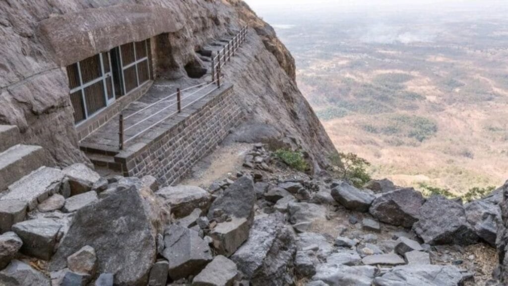
Today, Naneghat is known as a dramatic mountain pass in Maharashtra’s Western Ghats.
Nearly two thousand years ago, however, this same landscape connected two very different worlds: the ports of the Konkan coast and the settlements of the Deccan plateau.
Merchants, travellers and political authorities could move between the coast and the interior through this difficult mountain corridor.
But the most intriguing thing at Naneghat isn’t the ancient road itself.
It is the cave beside it.
Inside that cave, inscriptions preserve the names of an early royal family, record elaborate rituals and identify a powerful figure who was not a Satavahana king.
His name was Tranakayira.
His title was Mahārathi.
And according to the conventional reconstruction, his daughter was Queen Naganika, who became associated with the Satavahana royal family.
This raises a much bigger question:
Did the Satavahanas simply control this strategic gateway, or did they build their early power by negotiating with regional elites who already held influence across the Western Deccan?
The Naneghat inscription does not give us a simple answer.
In fact, its damaged text leaves historians debating some of the most important details.
And that uncertainty may be what makes Naneghat so fascinating.
Naneghat Was a Gateway Between the Coast and the Deccan
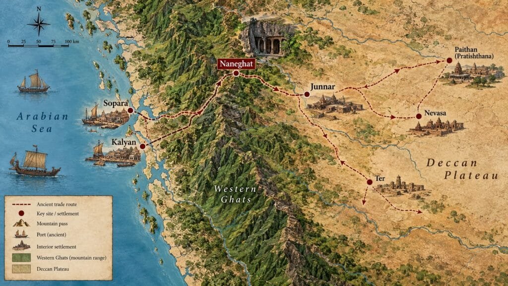
Naneghat crosses the Western Ghats near Junnar, connecting the Konkan side of Maharashtra with the Deccan interior.
Its importance came largely from geography.
The Western Ghats form a substantial natural barrier between the coastal plain and the plateau.
A pass through that barrier could therefore become important for communication and commerce.
Naneghat was not an isolated road but part of the wider ancient Indian Ocean trade network that connected India’s interior with ports and distant markets.
It belonged to a wider network of routes connecting inland settlements with coastal centres such as Kalyan and Sopara. Junnar and the surrounding region became important nodes within this larger landscape.
The better way to imagine ancient Naneghat is therefore not as a single “trade highway,” but as one gateway within a network:
Arabian Sea
↓
Konkan ports
↓
Western Ghats passes
↓
Junnar
↓
Deccan interior
The mountain pass mattered because it connected different economic and political zones.
Why Was a Royal Monument Built Beside the Pass?
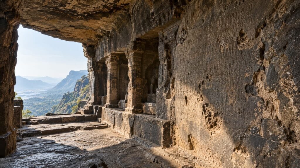
This is where the story becomes unusual.
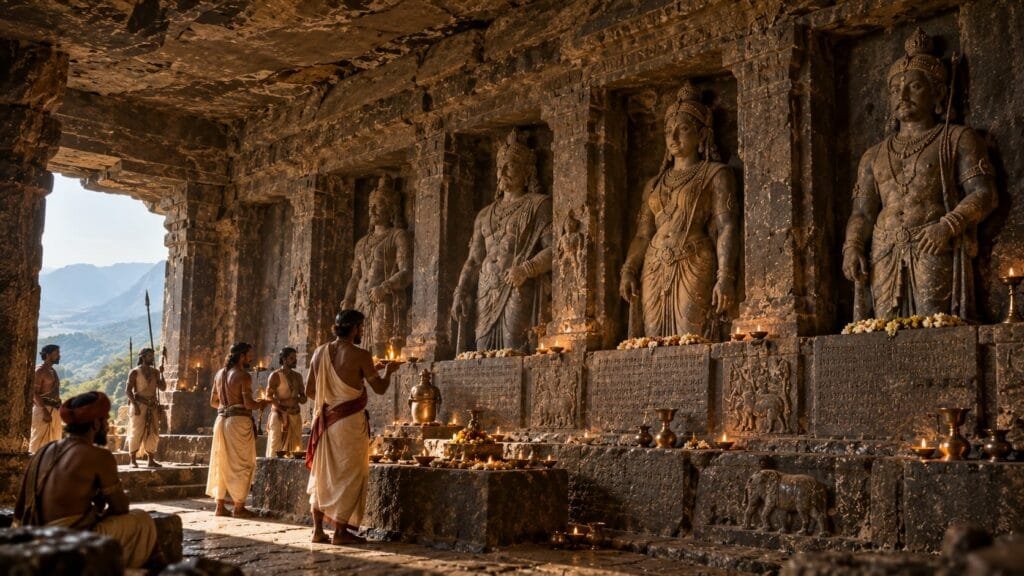
The Naneghat cave contains inscriptions written in Prakrit using Brahmi script.
The surviving labels identify members of an early Satavahana royal family.
Among the names associated with the monument are Simuka, Satakarni, Naganika and royal princes.
But another name appears alongside them:
Mahārathi Tranakayira.
The inclusion of Tranakayira is important.
He was not presented simply as another anonymous individual.
His title, Mahārathi, identifies him as a member of an important political or elite category in the early Deccan.
And according to the conventional reconstruction, he was connected to Naganika’s family.
That means the monument potentially preserves more than a royal genealogy.
It preserves a relationship between the Satavahana royal house and a powerful regional elite.
Who Was Mahārathi Tranakayira?
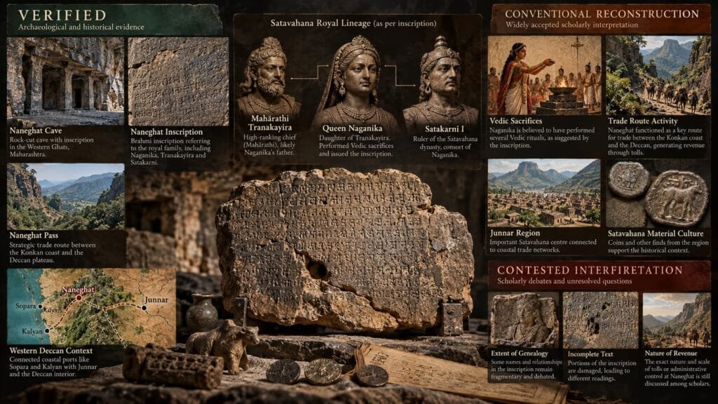
The exact political status of the Mahārathis remains a subject of historical discussion.
The term should not be confused with the much later history of the Marathas.
In the early Deccan context, Mahārathi appears to have been an important title associated with regional elites.
At Naneghat, Tranakayira is explicitly identified with that title.
The conventional reconstruction places him as the father of Naganika, the queen associated with Satakarni I.
If that reconstruction is correct, the relationship can be represented simply:
Mahārathi Tranakayira
↓
Naganika
↓
Marriage to Satakarni I
↓
Satavahana royal family
This does not prove that the marriage was deliberately arranged to secure control over Naneghat.
The inscription never says that.
But the combination of a powerful regional chief, a royal marriage and a strategically located mountain gateway raises an important historical possibility:
The early Satavahana state may have depended partly on relationships with regional elites rather than simply replacing them.
The Forgotten Political World of the Western Deccan
The early Deccan was not necessarily governed like a modern centralized state.
Archaeological and inscriptional evidence points to the presence of several regional political groups and elite titles.
Among those discussed by historians are:
- Mahārathis
- Mahābhojas
- Kumāras
- Rathikas/Raṭṭhikas
Their exact relationships with the Satavahanas are debated, and those relationships may also have changed over time.
This matters because the traditional image of an empire can be misleading.
A map might show a large Satavahana political sphere.
But political control on the ground could involve:
royal authority
regional chiefs
local settlements
commercial communities
religious institutions
The result may have been a political landscape based partly on negotiation, alliances and overlapping authority.
Naneghat provides an unusually valuable glimpse into that world.
The Marriage of Naganika and Satakarni
Naganika occupies a particularly important place in the Naneghat evidence.
She is associated with Satakarni I, one of the early Satavahana rulers.
The conventional genealogical reconstruction identifies her as the daughter of Mahārathi Tranakayira.
If correct, this means Naganika’s marriage connected two elite families:
A regional Mahārathi family
and
the Satavahana royal house.
It is tempting to describe this as a political alliance.
That interpretation is plausible, particularly given the strategic geography of Naneghat.
But it remains an interpretation.
The surviving inscription does not explicitly explain the political purpose of the marriage.
That distinction matters when reconstructing ancient history from fragmentary evidence.
The Naneghat Inscription Is More Than a Trade Record
It would be easy to describe the Naneghat inscription as evidence that ancient traders used the mountain pass.
But that misses much of what makes the inscription remarkable.
It records royal genealogy and ritual activity.
The inscription associates Satakarni and Naganika with a series of major sacrifices, including the Aśvamedha and Rājasūya.
These were not insignificant ceremonies.
They were associated with royal status and political legitimacy.
The inscription also records substantial gifts and ritual expenditure.
Naneghat was therefore not simply documenting movement through a mountain pass.
It was presenting a particular image of royal power.
Why Put That Message at a Mountain Pass?
This is one of the most intriguing questions.
The monument was not located in an obvious royal capital.
It was placed beside a strategically important route.
That raises a possibility:
The location itself may have been part of the message.
Anyone moving through the pass would encounter a monument associated with the ruling dynasty.
The monument communicated:
- who the royal family was;
- who belonged to it;
- which rituals had been performed;
- what religious traditions were being invoked;
- and which individuals were important enough to be commemorated.
We cannot prove that the monument was deliberately designed as political propaganda for passing merchants.
But its location and contents make the possibility worth considering.
The Naneghat cave can therefore be understood as both a religious and political monument.
Naganika's Role Is More Important Than It First Appears
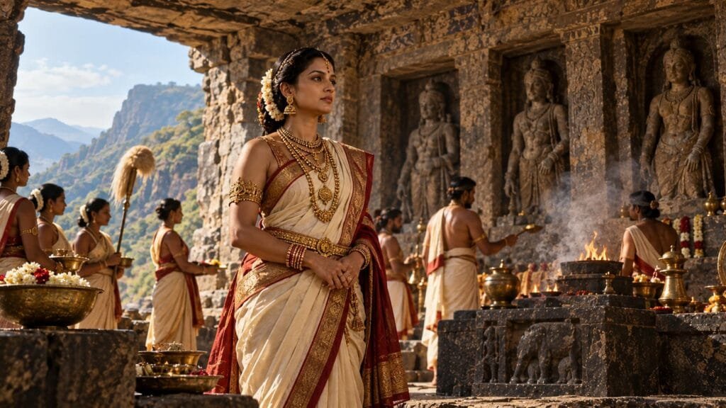
Naganika is not simply mentioned as someone’s wife.
The inscription places her within the ritual and dynastic world of the Satavahanas.
Historical interpretations of the inscription distinguish between sacrifices performed jointly by Satakarni and Naganika and rituals associated with Naganika herself.
This makes her an unusually visible female figure in early Deccan political history.
Her presence also makes the connection with the Mahārathi family particularly important.
Through Naganika, the inscription potentially connects:
regional aristocracy
↓
royal marriage
↓
Satavahana dynasty
↓
ritual sovereignty
The monument therefore tells us something about the political importance of royal women as well as kings.
But There Is a Problem With the “Naganika Inscription”
For a long time, the large Naneghat inscription has commonly been called the Naganika inscription.
That attribution is traditional and remains important in scholarship.
But the inscription is badly damaged.
Several portions are incomplete, and different scholars have interpreted the surviving text differently.
This has produced an intriguing alternative interpretation.
Historian Smita Halder has argued that the long inscription may not have been issued by Naganika at all.
Her reconstruction proposes that another royal woman may have been responsible for the inscription, with the surviving text potentially preserving a name beginning with Sīma.
She also argues that the statue gallery and the large inscription may represent different chronological phases.
This is a contested scholarly interpretation, not an established replacement for the conventional attribution.
But it creates an important historical question:
What if the monument preserves more than one phase of political activity?
The Even More Obscure Mystery: The Kumāras
Halder’s interpretation goes further.
She connects parts of the Naneghat evidence with Kumāra political groups and the wider Mahārathi/Rathika political environment.
Her reconstruction proposes that such regional powers may have exercised authority across a zone involving:
Junnar
↓
Naneghat
↓
Kalyan
If correct, this would significantly complicate the conventional picture.
Rather than imagining Naneghat as a place where the Satavahana state simply imposed centralized authority, we would have to consider a landscape in which multiple political powers interacted around the same strategic corridor.
But this interpretation depends on disputed readings of damaged inscriptions.
It therefore belongs in the article as a historical hypothesis, not as established fact.
Who Actually Controlled Naneghat?
This is perhaps the question that cannot currently be answered with complete certainty.
We can establish that:
- Naneghat was strategically positioned between the Konkan and Deccan.
- The region formed part of a wider commercial network.
- The early Satavahanas had an important presence there.
- Tranakayira was identified as a Mahārathi.
- Naganika was associated with the Satavahana royal family.
- The monument commemorated royal rituals and genealogy.
But we cannot confidently say:
“The Mahārathis controlled Naneghat.”
Nor can we confidently reconstruct a modern-style administrative system in which the Satavahana state directly managed every aspect of the route.
The evidence is simply not that precise.
What we can say is more interesting:
The Naneghat evidence points toward a political landscape in which royal authority existed alongside powerful regional elites.
The Mysterious Stone Vessel
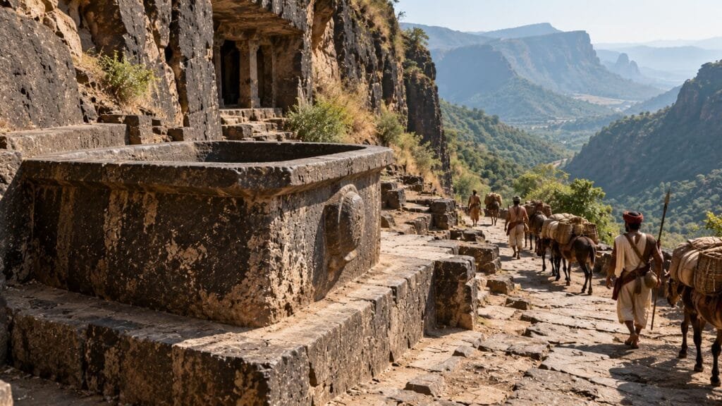
There is another famous feature at Naneghat: a large stone vessel traditionally known as Jakaticha Ranjan.
It is commonly interpreted as an ancient vessel used for collecting tolls.
This has produced a popular story of Naneghat as an ancient toll station.
But the evidence needs to be handled carefully.
The vessel exists.
Its association with toll collection is a long-standing interpretation.
But there is no surviving inscription saying:
“This vessel was installed here by the Satavahanas for collecting customs.”
Nor can we confidently establish from the vessel alone exactly when it was installed or how it was used.
So the strongest historical argument is not:
“The pot proves Naneghat was a toll booth.”
Instead, the evidence should be assembled from the wider landscape:
strategic geography
trade networks
settlement archaeology
inscriptions
political activity
Together, these make Naneghat’s economic importance much more convincing.
The Merchants Were Part of a Much Bigger Network
The story does not end at the mountain pass.
Nearby Junnar contains extensive evidence of early historic activity.
The wider Western Deccan cave landscape also contains inscriptions recording donations from people described as Yavanas.
The term Yavana had changing meanings in ancient Indian sources, so it should not automatically be translated as “Roman.”
But these inscriptions demonstrate that people identified as Yavanas participated in the religious and social environment of the region.
This is important because it shows that the Western Deccan was not an isolated inland world.
It was connected to wider networks of movement and commerce.
The route through Naneghat ultimately linked the interior with the Arabian Sea.
From Mountain Pass to Maritime Trade
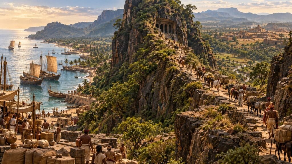
Think of the network as a chain:
Arabian Sea
↓
Sopara and Kalyan
↓
Konkan
↓
Naneghat
↓
Junnar
↓
Deccan interior
Goods and people did not necessarily travel along this exact sequence every time.
Ancient trade networks were more complicated than a single road.
But the geography demonstrates why the Western Ghats passes mattered.
They connected coastal maritime commerce with inland markets and settlements.
Control or influence over such corridors could therefore provide political as well as economic advantages.
The Religious Landscape Was Also Complex
The Naneghat inscription invokes a striking range of divine figures, including:
- Indra
- Surya
- Chandra
- Yama
- Varuna
- Kubera
- Saṃkarṣaṇa
- Vāsudeva
The combination is significant.
It shows a religious environment in which Vedic ritual traditions existed alongside forms of devotion associated with figures such as Saṃkarṣaṇa and Vāsudeva.
Naneghat therefore cannot easily be reduced to a single religious category.
It offers a snapshot of a period when different religious traditions were interacting within the political culture of the Deccan.
A Mountain Cave Also Preserves Early Numerals
Naneghat has another claim to historical importance.
The inscriptions preserve early forms of several numerals, including forms associated with 2, 4, 6, 7 and 9.
That makes the site significant not only for political and religious history but also for the history of Indian writing and numeration.
In one location, therefore, we find evidence relating to:
royalty
trade
religion
political titles
writing
numeration
That is remarkable for a cave beside a mountain route.
The Forgotten People Were Not Necessarily the Traders
Our original question was:
Who controlled India’s ancient mountain trade routes?
The evidence suggests that this question may be slightly misleading.
The people we have forgotten may not have been the merchants themselves.
They may have been the regional political elites who stood between local society and expanding kingdoms.
The Mahārathis are particularly interesting because one of them appears directly within the Naneghat royal monument.
Their precise powers remain uncertain.
They may have exercised territorial authority, military influence or control over local communities and strategic areas.
They may have negotiated with larger dynasties.
And some may have become connected to royal families through marriage.
What we can see at Naneghat is not a complete political system.
But we can see its outlines.
The Bigger Story: How Did the Satavahanas Build Power?
This is where Naneghat becomes more than an archaeological curiosity.
The early Satavahana state emerged in a region that already contained:
regional elites
settlements
commercial networks
religious institutions
mountain corridors
coastal ports
The dynasty therefore had to operate within an existing landscape.
One possible model is conquest.
Another is negotiation.
The evidence from Naneghat makes the second possibility difficult to ignore.
The presence of a Mahārathi connected to the royal family suggests that relationships with regional elites may have been an important component of early Satavahana political expansion.
But the exact nature of those relationships remains uncertain.
What the Naneghat Evidence Can—and Cannot—Tell Us
| Question | Evidence |
|---|---|
| Was Naneghat strategically important? | Strongly supported |
| Did it connect the Konkan and Deccan? | Strongly supported |
| Was it part of a wider commercial network? | Strongly supported |
| Did the Satavahanas have a major presence there? | Strongly supported |
| Was Tranakayira identified as a Mahārathi? | Direct inscriptional evidence |
| Was Tranakayira Naganika’s father? | Conventional reconstruction |
| Was Naganika associated with Satakarni? | Strongly supported |
| Was the large inscription definitely written by Naganika? | Traditional attribution, but disputed |
| Did Mahārathis control the entire route? | Not established |
| Did Kumāra/Mahārathi groups control the Junnar–Naneghat–Kalyan zone? | A scholarly interpretation, particularly associated with Halder |
| Was the stone vessel definitely a Satavahana toll container? | Traditional interpretation, not conclusively demonstrated |
This distinction between evidence and interpretation is crucial.
Ancient history often survives in fragments.
Sometimes the most honest answer is not “this happened.”
It is:
“This is what the evidence allows us to reconstruct.”
The Mountain Pass That Became a Political Stage
Naneghat was valuable because of where it stood.
The pass connected the coast and plateau.
The surrounding settlements connected merchants and religious institutions.
Regional elites operated within the same landscape.
And the Satavahana dynasty placed a monument there that proclaimed its royal identity.
That makes Naneghat more than a trade route.
It was potentially a political stage positioned inside an economic corridor.
The people passing through were moving through a landscape in which geography, commerce and power overlapped.
The Final Mystery of Naneghat
The most fascinating thing about Naneghat may be what we still cannot completely reconstruct.
We know that the Satavahanas were there.
We know that Naganika was associated with their royal family.
We know that a Mahārathi named Tranakayira was important enough to be represented in the monument.
We know that the region was connected to wider commercial networks.
We know that major royal rituals were commemorated.
But the damaged inscription leaves us with unanswered questions.
Who exactly controlled the pass?
How much authority did the Mahārathis possess?
Was the royal marriage part of a wider political alliance?
Were regional powers incorporated into Satavahana rule rather than simply defeated?
And was the inscription we call “Naganika’s” actually commissioned by her?
We may never be able to answer all of these questions.
But that uncertainty is not a weakness in the story.
It is the story.
The Forgotten Powers Behind the Route
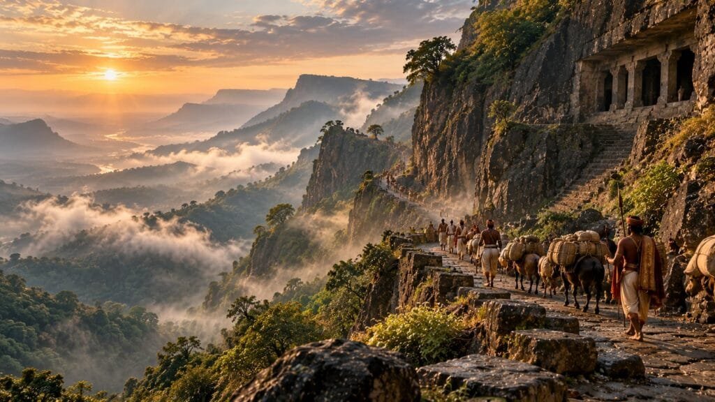
Naneghat is often presented as an ancient route through the Western Ghats.
That is true—but incomplete.
Behind the road was a much larger world.
There were merchants travelling between coast and plateau.
There were religious communities receiving donations.
There were regional elites whose titles survive in inscriptions.
There were royal families building alliances.
And there was a rising dynasty attempting to establish itself across a politically complicated landscape.
The Naneghat inscription preserves one of the rare moments when several of these worlds appear in the same historical frame.
The Satavahanas may have become one of the major powers of the Deccan.
But the monument at Naneghat reminds us that they did not emerge into an empty landscape.
They inherited, negotiated with and perhaps incorporated older networks of regional power.
And somewhere in that process stood a mountain pass.
A pass that connected the sea to the plateau.
A pass where merchants travelled.
A pass where political authority mattered.
And a cave where the names of kings, queens and forgotten chiefs were carved into stone.
Nearly two thousand years later, the road remains.
The people who negotiated its power are much harder to see.
Sources & Further Reading
- V. V. Mirashi, The History and Inscriptions of the Satavahanas and the Western Kshatrapas (Maharashtra State Board for Literature and Culture, 1981).
- Upinder Singh, A History of Ancient and Early Medieval India: From the Stone Age to the 12th Century (Pearson).
- Smita Halder, “Revisiting the Naneghat Inscriptions”, Proceedings of the Indian History Congress, 2016.
- Shobhana Gokhale, Junnar Inscriptions (Bhandarkar Oriental Research Institute, 2019); see also her reading of the Naneghat Vedic rituals in this paper.
- Archaeological Survey of India, Monuments of National Importance, Mumbai Circle (entry N-MH-M24, “Caves and inscription at the Nana Pass (Naneghat)”).
- Himanshu Prabha Ray, Monastery and Guild: Commerce under the Sātavāhanas (Oxford University Press, 1986).
- Jeremy A. Simmons, “Behind gold for pepper: The players and the game of Indo-Mediterranean trade”, Journal of Global History, 2023.