
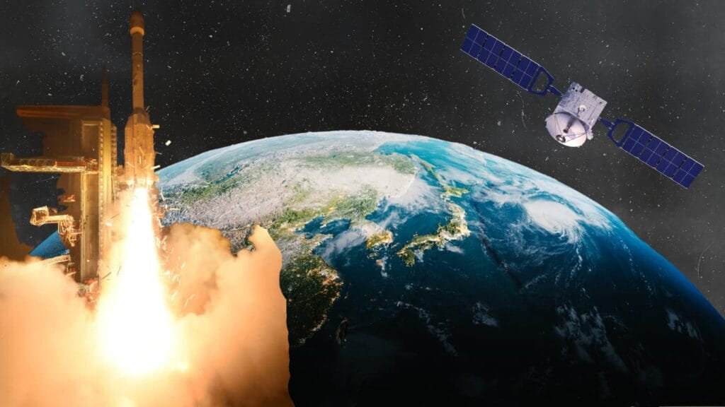
On September 4, 2026, India’s GSLV-F17 successfully placed EOS-05, a state-of-the-art Earth-observation satellite, into a sub-geosynchronous transfer orbit. ISRO describes EOS-05 as India’s first imaging satellite from geosynchronous orbit. The following day, ISRO reported that its first orbit manoeuvre had also been successfully completed.
It looks like another impressive achievement in India’s growing space programme.
But the real story began much earlier.
Long before EOS-05, before NISAR, before Cartosat and Resourcesat, India had to learn something surprisingly difficult: how to use space technology to understand problems on Earth.
That is where the ISRO history becomes far more interesting than a list of rocket launches and famous missions.
India’s space programme was never conceived simply as a race to reach the Moon or compete with the world’s richest nations. From its earliest days, its scientists were asking a more practical question:
Could space technology help solve problems on the ground?
Almost six decades later, EOS-05 is part of the answer.
The idea that changed India's space programme
The foundations of the Indian space programme were laid in the early 1960s.
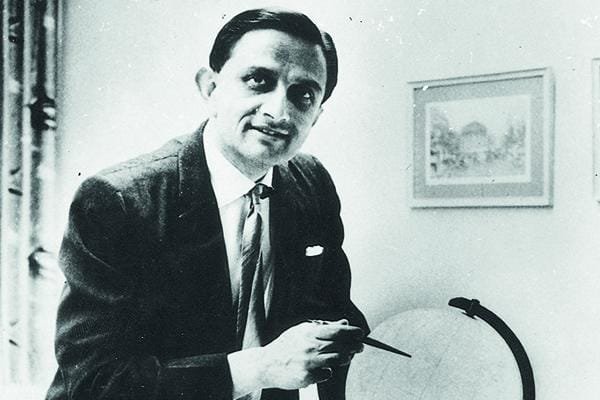
At the centre of that story was Dr. Vikram Sarabhai, widely regarded by ISRO as the founding father of India’s space programme.
Sarabhai understood something that was unusual for the time.
India was a developing country with enormous challenges in agriculture, communications, education, weather forecasting and resource management. Spending money on space might therefore seem like a luxury.
Sarabhai saw it differently.
ISRO’s account of its origins explains that the early space programme was motivated by the potential of space technology to address real problems facing society.
The philosophy was simple:
India did not need space technology merely to demonstrate that it could reach space. It needed space technology because space could help India solve problems on Earth.
That idea would eventually become one of the defining characteristics of ISRO history.
Before ISRO, there was INCOSPAR
The organisation we now know as ISRO did not appear overnight.
In 1962, the Indian government established the Indian National Committee for Space Research, or INCOSPAR, under the Department of Atomic Energy. Sarabhai played a central role in building the programme.
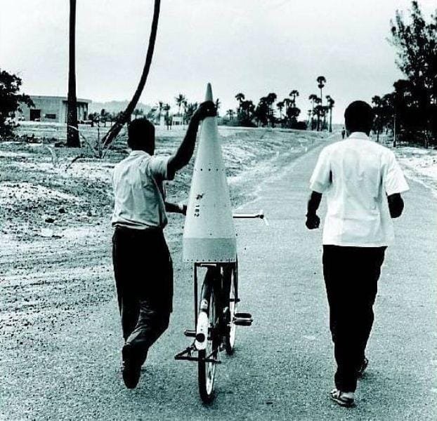
The first major launch site was established at Thumba, near Thiruvananthapuram.
The location was strategically important because of its proximity to the Earth’s magnetic equator.
On November 21, 1963, India launched its first rocket from Thumba: a Nike-Apache sounding rocket acquired from the United States.
At that point, India wasn’t launching sophisticated satellites.
It was learning.
Learning how rockets behaved.
Learning how to conduct experiments.
Learning how to track objects in the atmosphere.
Learning how space technology could eventually be converted into something useful.
That experimental culture became the foundation for everything that followed.
1969: ISRO is born
Seven years after INCOSPAR was created, India took another major step.
ISRO was formally established on August 15, 1969.
The organisation replaced INCOSPAR with an expanded mandate to develop and apply space technology for India’s national needs.
Three years later, in 1972, the Department of Space and Space Commission were established, and ISRO was brought under the Department of Space.
This institutional structure mattered.
India wasn’t treating space as an isolated scientific experiment anymore.
It was becoming a national technology programme.
And the next challenge was obvious:
India needed its own satellites.
The first Indian satellite wasn't about Earth observation
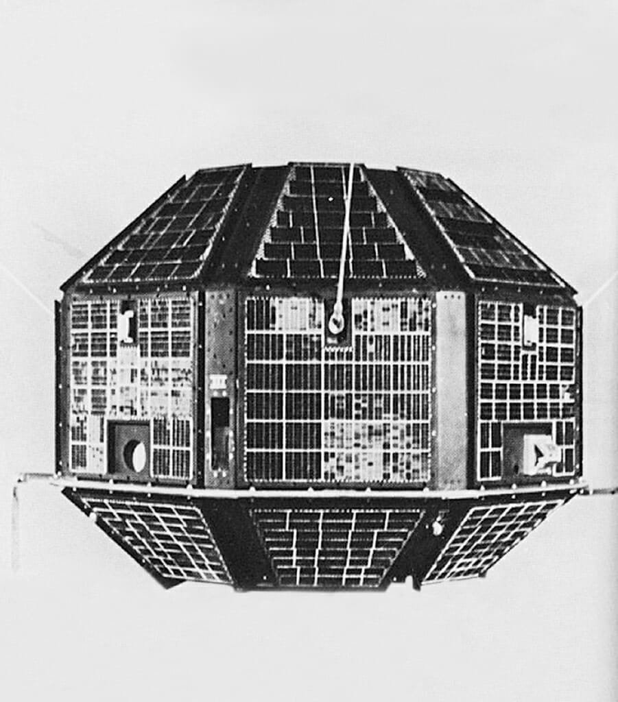
The first Indian satellite was Aryabhata, launched in 1975 with Soviet assistance.
It represented an important milestone in India’s ability to design and build spacecraft.
But India’s satellite ambitions were much broader than scientific experiments.
The country needed satellites that could help with communication, meteorology, education and—eventually—something particularly valuable for a huge agricultural nation:
seeing its own land from above.
That would lead to one of the most important chapters in ISRO history.
Bhaskara: India's early attempt to see Earth from space
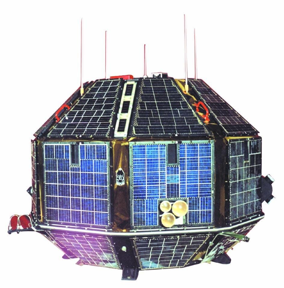
India’s early Earth-observation story is closely connected with the Bhaskara satellites.
Bhaskara-I, launched in 1979, was an experimental Earth-observation satellite.
Bhaskara-II followed in 1981.
These missions were important because they helped India gain experience in collecting data about Earth’s surface from space.
This was fundamentally different from simply putting a satellite into orbit.
The challenge was now:
How do you turn what a satellite sees into information that someone on Earth can actually use?
That question would define India’s remote-sensing programme for decades.
And it is one reason the history of India’s space programme cannot be separated from the history of Earth observation.
1988: India begins seeing its resources from space
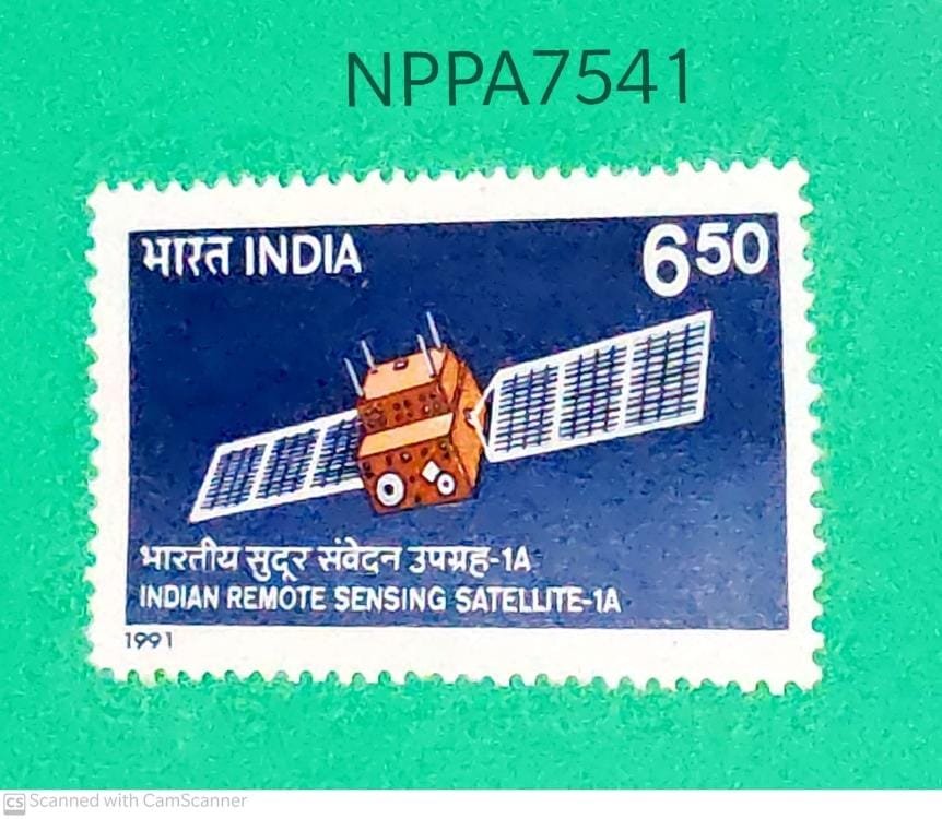
The next major turning point came with IRS-1A.
Launched in 1988, IRS-1A became the first satellite of India’s operational Indian Remote Sensing programme.
This was a major change.
India was moving from experimental Earth observation toward a sustained system designed to provide useful information about the country’s resources.
Satellites could help scientists and planners study things such as:
- agriculture
- forests
- water resources
- land use
- mineral resources
- environmental conditions
The basic concept was revolutionary:
Instead of sending people everywhere to inspect India’s enormous landscape, satellites could provide a view from above.
That idea would eventually become central to modern India.
Why seeing India from space mattered
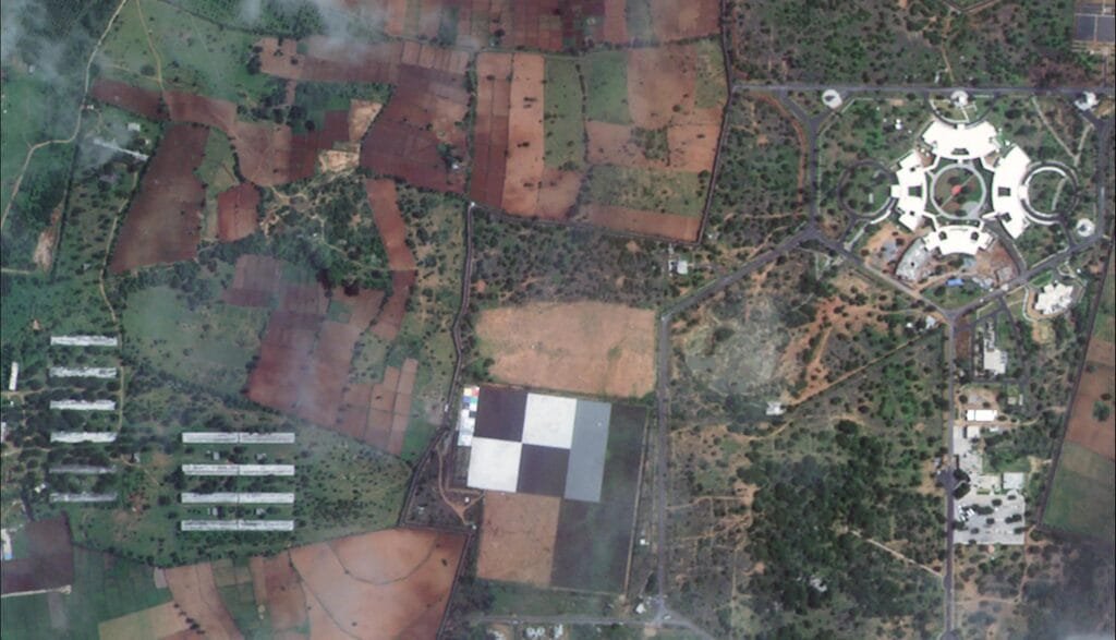
Imagine trying to monitor India’s forests from the ground.
Or track changing agricultural patterns across millions of hectares.
Or understand how rivers, reservoirs and groundwater resources are distributed.
Or map a rapidly expanding city.
The scale of India makes many of these tasks extraordinarily difficult from the ground.
Satellites changed the equation.
Remote sensing could provide repeated observations over huge areas.
That meant the same technology could support agriculture, water management, disaster response, urban planning and environmental monitoring.
This is where our current ISRO history connects directly to everyday India.
For example, India’s relationship with water is a story of thousands of years of engineering and management. We’ve previously explored that deeper historical relationship in our article on water management in India. The satellite era added an entirely new technological layer to that old problem.
From IRS to Resourcesat, Cartosat and beyond
The success of the Indian Remote Sensing programme led to increasingly specialised satellites.
Different missions were designed for different purposes.
Resourcesat focused on resource monitoring.
Cartosat missions became particularly important for high-resolution cartographic applications.
Oceansat missions contributed to observations of the oceans.
RISAT missions introduced radar-based Earth observation capabilities.
The underlying philosophy remained remarkably consistent:
Look at Earth from space. Collect information. Turn that information into something useful on Earth.
That is perhaps the most important thread running through the entire ISRO history of Earth observation.
The satellite revolution changed how India understands its geography
The significance goes beyond rockets and satellites.
India is an extraordinarily geographically diverse country.
The Himalayas, Indo-Gangetic plains, deserts, forests, coastlines, islands, agricultural belts and enormous cities all require different kinds of monitoring.
Earth observation provides a common technological window into these different environments.
That matters particularly when natural events occur.
Floods can alter landscapes rapidly.
Landslides can reshape mountain roads and settlements.
Cyclones can transform coastlines.
Drought can affect agricultural regions over huge areas.
Satellite imagery gives authorities something that ground observations alone cannot provide:
scale.
That is also why our previous HypeHive coverage of India’s monsoon system provides a useful companion to this story: Why Does India Have a Monsoon-Type Climate?
The monsoon may be thousands of years old as a force shaping Indian civilisation, but modern satellites have given India increasingly sophisticated ways to observe it.
Then came a new generation of Indian satellites
By the 21st century, India’s satellite programme had moved far beyond the experimental missions of the 1970s.
The country had developed multiple launch vehicles and increasingly capable spacecraft.
The PSLV, for example, earned ISRO’s famous description as its “workhorse” because of its consistent performance in delivering satellites to low Earth and other orbits.
The launch vehicle itself became an important part of India’s technological independence.
The satellite could be designed in India.
The instruments could be developed in India.
The launch vehicle could increasingly be developed and operated in India.
And the data could be processed and used by Indian institutions.
The result was something much bigger than individual missions.
India was building an entire space ecosystem.
NISAR: Earth observation enters another era
In 2025, another major milestone arrived with NISAR, the NASA-ISRO Synthetic Aperture Radar mission.
NISAR represented an important expansion of India’s Earth-observation capabilities, combining the expertise of two major space agencies.
It also demonstrated how India’s space programme had evolved from its early experimental satellites into sophisticated international scientific missions.
By this point, the question was no longer simply:
Can India observe Earth from space?
The question had become:
How much more can India learn from observing Earth from space?
And then came EOS-05.
EOS-05: Why the 2026 mission matters
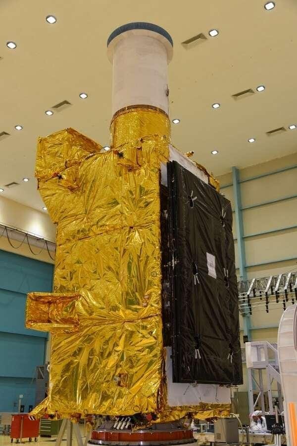
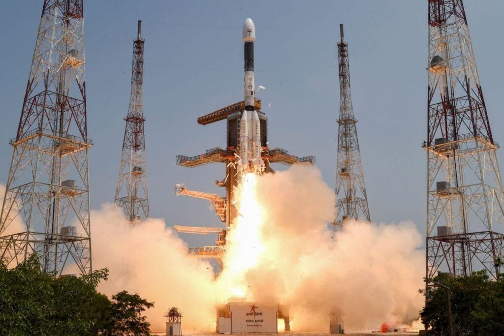
On September 4, 2026, GSLV-F17 launched EOS-05.
According to ISRO, it is an Earth-observation spacecraft and India’s first imaging satellite from geosynchronous orbit.
The launch placed the satellite into a sub-geosynchronous transfer orbit.
On September 5, ISRO announced that the first orbit manoeuvre had successfully been completed. Further manoeuvres are planned to eventually place EOS-05 in a geosynchronous orbit at 85.5° East.
That makes EOS-05 an interesting point in the long story of India’s Earth-observation programme.
It represents another step in a journey that began with experimental satellites such as Bhaskara and matured through the Indian Remote Sensing programme.
In other words:
EOS-05 did not appear out of nowhere.
It is the product of decades of accumulated knowledge.
From Bhaskara to EOS-05: What actually changed?
The simplest way to understand the evolution is to look at the question India was trying to answer at each stage.
| Era | The question |
|---|---|
| 1960s | Can India develop space technology? |
| 1970s | Can India build and operate satellites? |
| Bhaskara era | Can satellites observe Earth? |
| IRS era | Can Earth observation become operational? |
| Resourcesat/Cartosat era | Can satellite data solve national problems? |
| NISAR era | Can India undertake increasingly sophisticated radar observation? |
| EOS-05, 2026 | How much more precisely can India observe Earth from geosynchronous orbit? |
That is the real ISRO history behind today’s headlines.
The technology changed.
The satellites changed.
The launch vehicles changed.
But the underlying purpose remained remarkably consistent.
ISRO was never only about going to space
This is perhaps the most important thing to understand.
When people hear ISRO, they often think about:
Chandrayaan.
Mangalyaan.
Gaganyaan.
Moon landings.
Mars.
Those missions are extraordinary.
But a huge part of India’s space programme has always been much closer to Earth.
Communication.
Navigation.
Weather.
Agriculture.
Water.
Forestry.
Mapping.
Disaster management.
Resource monitoring.
The organisation itself states that its objective is to develop and apply space technology for national needs, including communication, meteorological services, resource monitoring and management, and navigation.
That’s why the story of ISRO history is ultimately not just a story about space.
It is a story about using space to understand India better.
ISRO was never only about going to space
This is perhaps the most important thing to understand.
When people hear ISRO, they often think about:
Chandrayaan.
Mangalyaan.
Gaganyaan.
Moon landings.
Mars.
Those missions are extraordinary.
But a huge part of India’s space programme has always been much closer to Earth.
Communication.
Navigation.
Weather.
Agriculture.
Water.
Forestry.
Mapping.
Disaster management.
Resource monitoring.
The organisation itself states that its objective is to develop and apply space technology for national needs, including communication, meteorological services, resource monitoring and management, and navigation.
That’s why the story of ISRO history is ultimately not just a story about space.
It is a story about using space to understand India better.
And that brings us back to EOS-05
In 2026, an Indian satellite is once again moving through orbit.
From the ground, it may look like another technical milestone.
Another launch.
Another spacecraft.
Another entry in ISRO’s enormous mission archive.
But look backward and the picture changes.
Behind EOS-05 are decades of experiments.
Behind those experiments were Bhaskara.
Behind Bhaskara was the emergence of India’s Earth-observation ambitions.
Behind those ambitions was a larger philosophy.
And behind that philosophy was Vikram Sarabhai’s belief that a developing country could use advanced technology not simply for prestige, but to confront its real problems.
That is the remarkable thread running through ISRO history.
From a small rocket station to a window on Earth
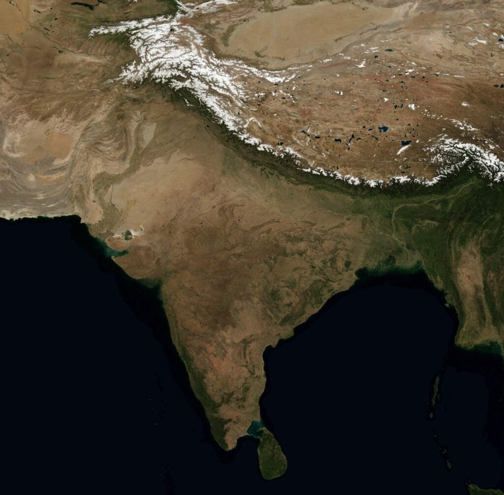
India’s space journey began at Thumba with a sounding rocket in 1963.
ISRO was established in 1969.
Aryabhata followed.
Bhaskara pushed India deeper into Earth observation.
IRS-1A transformed that experiment into an operational programme.
Resourcesat, Cartosat, Oceansat and RISAT expanded what India could observe.
NISAR demonstrated the power of advanced international collaboration.
And now EOS-05 is extending India’s Earth-observation capabilities into another orbital regime.
Nearly six decades after those first experiments, the original question remains surprisingly relevant:
What can space do for people on Earth?
India’s answer has never been simply “go farther.”
It has increasingly been:
“See better. Understand better. And use what we learn.”
And perhaps that is the most important lesson in the entire ISRO history.
Further reading
For readers who want to go deeper :
Primary external sources
- ISRO — GSLV-F17 / EOS-05 Mission — official mission details and EOS-05’s significance.
- ISRO — EOS-05 Orbit Manoeuvring Update — latest orbital manoeuvre status.
- ISRO — Genesis of the Indian Space Programme — origins of India’s space programme.
- ISRO — Dr. Vikram Sarabhai — Sarabhai’s role and philosophy.
- ISRO — About ISRO — official mandate and organisational history.
- ISRO — FAQ / Indian Space Programme milestones — formation dates and early launch history.
