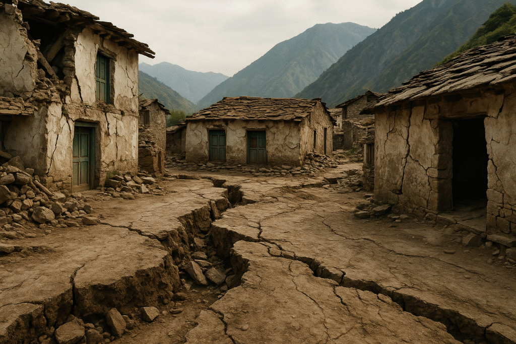
On August 5, 2025, the picturesque village of Dharali, located in Uttarkashi district of Uttarakhand, became the latest victim of nature’s overwhelming power. The cloudburst that struck the area left four people dead and more than fifty missing. The tragic event has added to Uttarakhand’s long history of natural disasters, marking a grim reminder of the state’s vulnerability to extreme weather and seismic events.
Uttarakhand, located in the northern part of India, is one of the most disaster-prone regions in the country. The combination of its mountainous terrain, intense weather patterns, and tectonic instability has made it the site of some of India’s most catastrophic natural calamities. The Dharali tragedy, while heartbreaking, is not an isolated event but rather a continuation of the state’s devastating history with natural disasters.
In this article, we explore the details of the Dharali cloudburst tragedy, the ongoing rescue efforts, and highlight the 10 most devastating natural calamities that have shaped Uttarakhand’s history.
The Dharali Cloudburst Tragedy: A Sudden Catastrophe
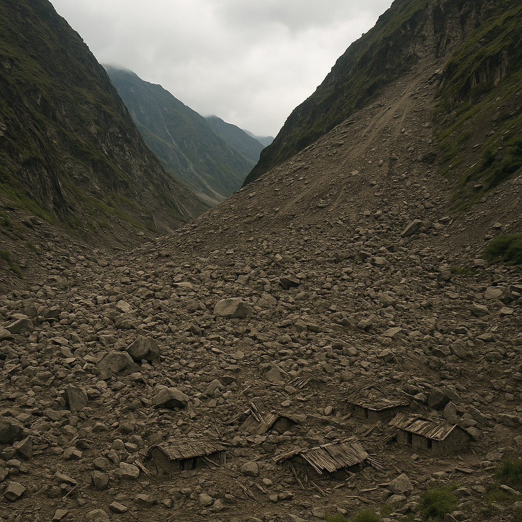
At around 1:45 PM on August 5, 2025, the serene village of Dharali was hit by a sudden cloudburst that triggered massive flash floods in the Kheer Ganga river. The floodwaters, mud, and debris rushed down the hillside with incredible force, completely engulfing the village within minutes.
The once peaceful village, known for its proximity to the Gangotri Dham pilgrimage route, became the epicenter of a devastating natural calamity. Eyewitnesses described scenes of utter chaos, with locals frantically trying to escape the rising floodwaters. Disturbing videos shared on social media showed villagers scrambling for their lives as water engulfed their homes, businesses, and markets.
Immediate Impact of the Dharali Cloudburst
4 confirmed deaths and over 50 people missing and feared trapped under debris.
20-25 hotels and homestays washed away or buried.
The entire Dharali market was swept away by the floodwaters.
30-40 houses severely damaged or completely destroyed.
Several villages in the valley cut off from the outside world.
The Indian Army, ITBP, NDRF, and local rescue teams rushed to the scene. Despite the challenging terrain, efforts to rescue those trapped under the debris continued. Unfortunately, the bad weather and damaged infrastructure, including the loss of crucial bridges, hampered progress.
A Second Cloudburst Strikes Sukhi Top
As if the tragedy wasn’t enough, just hours after the Dharali disaster, Sukhi Top, a nearby region, was also hit by a cloudburst. The disaster compounded the ongoing rescue efforts, as more houses were damaged, and an army camp was affected. The region remained on high alert, with authorities struggling to coordinate the response to both disasters.
Massive Rescue Operations Underway
In response to the devastating cloudburst, the Indian Army was the first to respond, with 150 personnel arriving within 10 minutes of the disaster. ITBP teams, NDRF, and local authorities were deployed to rescue and assist those in need. However, the region’s rugged terrain and the damaged road connectivity significantly delayed relief efforts.
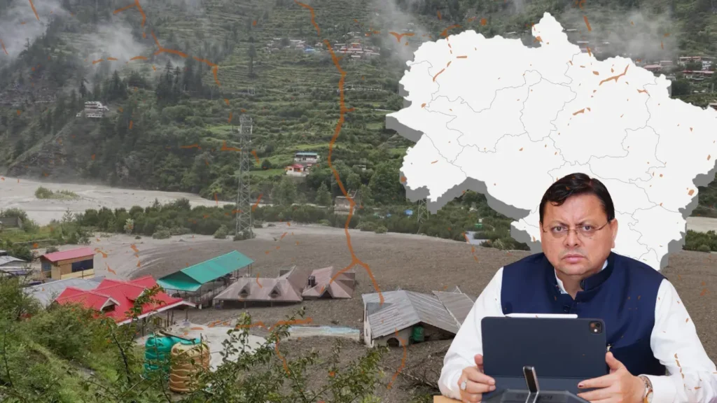
The Uttarakhand government activated emergency response measures, with Chief Minister Pushkar Singh Dhami personally coordinating relief efforts. Prime Minister Narendra Modi expressed his condolences and assured support to the state. Emergency helpline numbers were set up to assist affected residents.
Uttarakhand’s History of Natural Calamities
Uttarakhand, over the last century and a half, has witnessed some of the most devastating natural disasters in India. From massive floods and landslides to earthquakes and glacier bursts, these events have left lasting scars on the state’s residents and infrastructure. Here are the 10 most catastrophic natural calamities that have shaped the history of Uttarakhand.
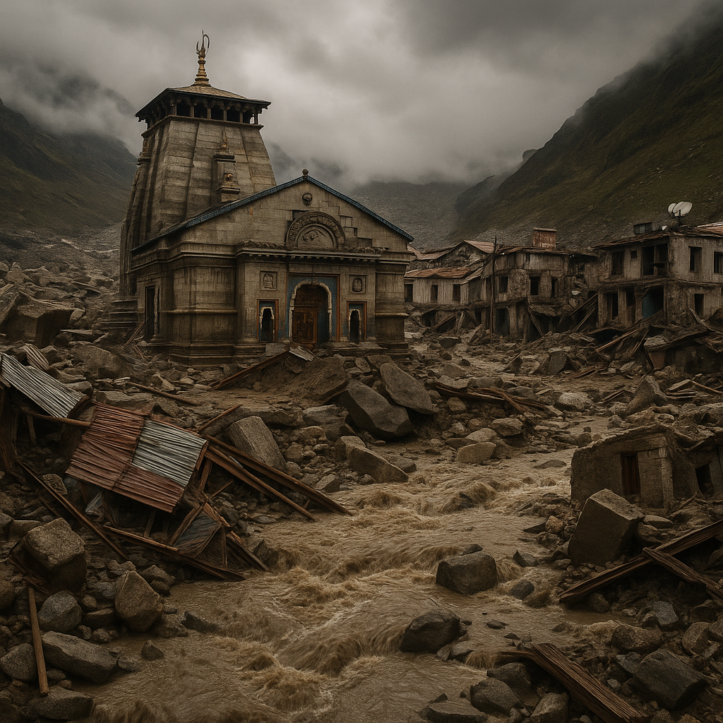
1. The 2013 Kedarnath Floods: The Himalayan Tsunami
The 2013 Kedarnath floods remain the most devastating disaster in Uttarakhand’s recorded history. The disaster occurred from June 13-17, 2013, when unprecedented rainfall—375% above normal monsoon levels—triggered flash floods and landslides, transforming the holy pilgrimage routes into death traps.
Over 5,700 people were presumed dead, with an official death toll of 6,054.
More than 300,000 pilgrims and tourists were trapped.
Economic losses exceeded $3.8 billion.
The Kedarnath Temple miraculously survived, with a massive boulder diverting floodwaters.
The floodwaters, combined with landslides, overwhelmed the entire region. The disaster remains a pivotal moment in the state’s modern history.
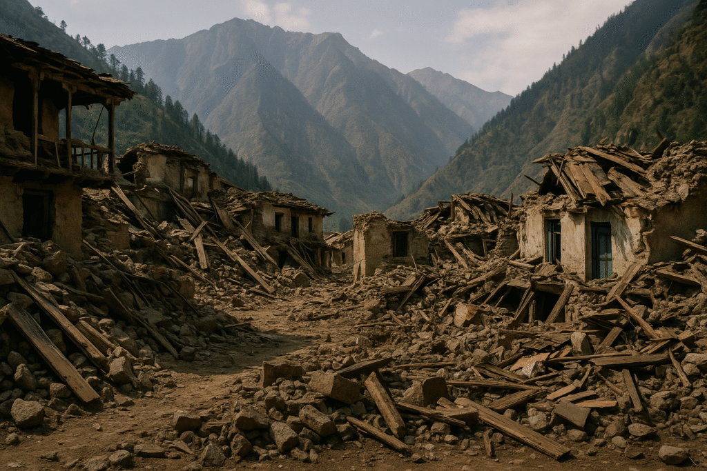
2. The 1991 Uttarkashi Earthquake: The Great Himalayan Tremor
On October 20, 1991, a 6.8 magnitude earthquake struck the Uttarkashi region, killing 768 people and causing extensive damage. The earthquake also highlighted the region’s vulnerability to seismic activity due to the ongoing tectonic collision between the Indian and Eurasian plates.
Thousands of homes were destroyed.
Entire villages were flattened, especially in Harshil and Uttarkashi.
Numerous landslides blocked roads and hampered rescue efforts.
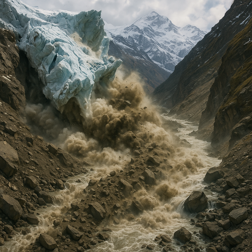
3. The 2021 Chamoli Glacier Burst: The Rishiganga Catastrophe
On February 7, 2021, a rock and ice avalanche from Ronti Peak triggered one of the most destructive flash floods in Uttarakhand’s recent history. The Rishiganga valley was hit with massive debris flow that wiped out the NTPC Tapovan-Vishnugad hydel project.
Over 200 people were either killed or went missing.
13 MW Rishiganga hydro project was destroyed.
Villages in the affected area were evacuated, and major rivers were dammed with debris.
This disaster, caused by a combination of rock fall and glacier melting, has drawn attention to the growing risks of climate change.
4. The 1998 Malpa Landslide: The Village That Vanished
On August 18, 1998, a massive landslide buried the small village of Malpa, killing 255 people, including 55 Kailash Mansarovar pilgrims. The entire village was wiped off the map, and debris blocked the Sharda River, causing further destruction.
Extreme rainfall during the monsoon season saturated the unstable slopes, triggering the landslide.
This tragedy highlighted the vulnerability of remote villages in the region.
5. The 1999 Chamoli Earthquake: Repeated Seismic Devastation
Just eight years after Uttarkashi, another powerful earthquake struck Chamoli on March 29, 1999, causing widespread damage. The earthquake had a 6.8 magnitude and left over 100 people dead.
Significant ground deformations and landslides altered water flow patterns.
The earthquake highlighted the region’s vulnerability to seismic hazards.
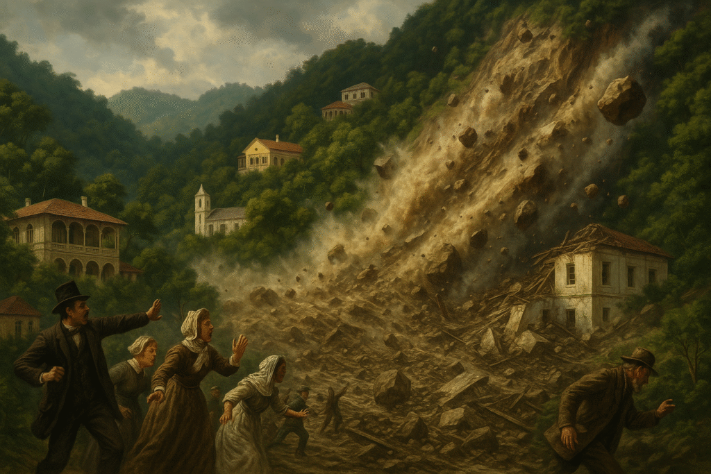
6. The 1880 Nainital Landslide: The Colonial Era Catastrophe
The Sher ka Danda landslide, which occurred on September 18, 1880, remains one of the earliest recorded disasters in Uttarakhand during the British colonial era.
151 people died, including 43 Europeans and Eurasians.
The disaster led to early recognition of the geological risks in hill stations.
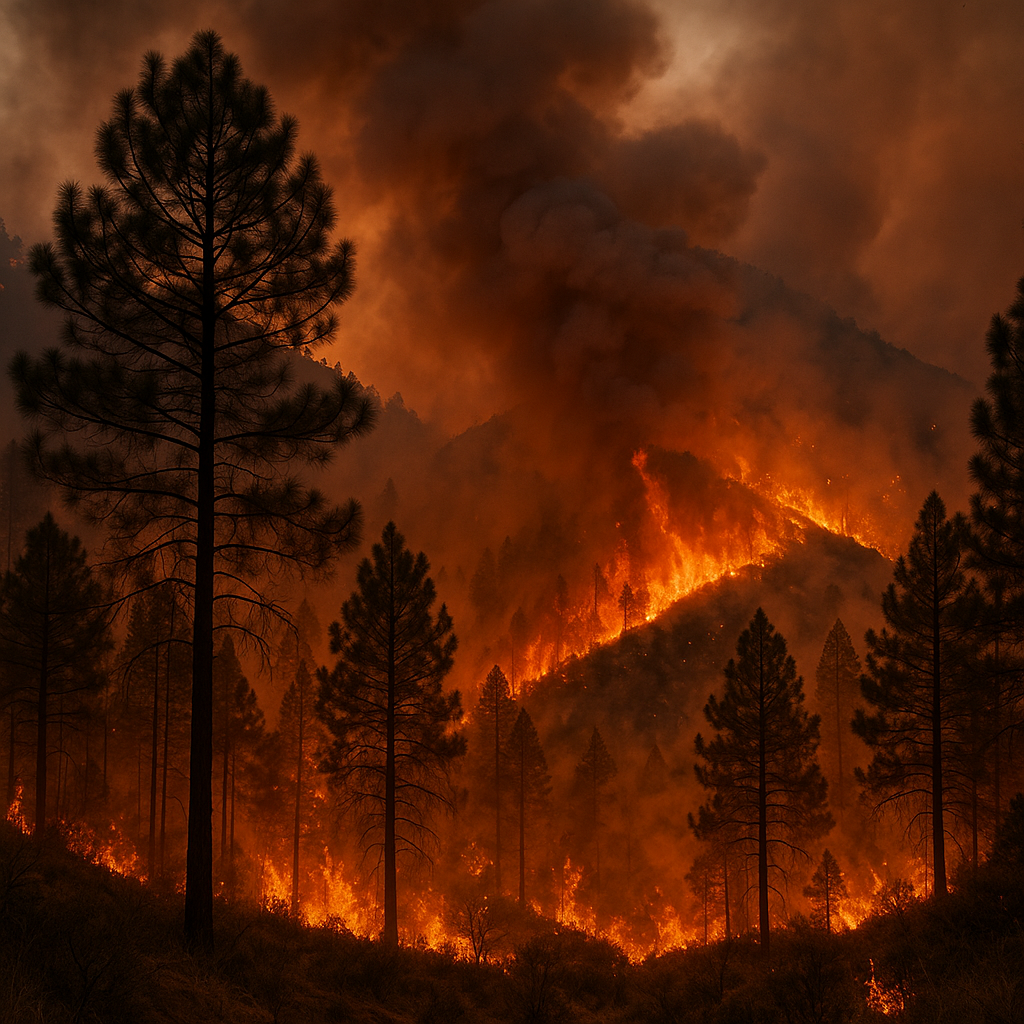
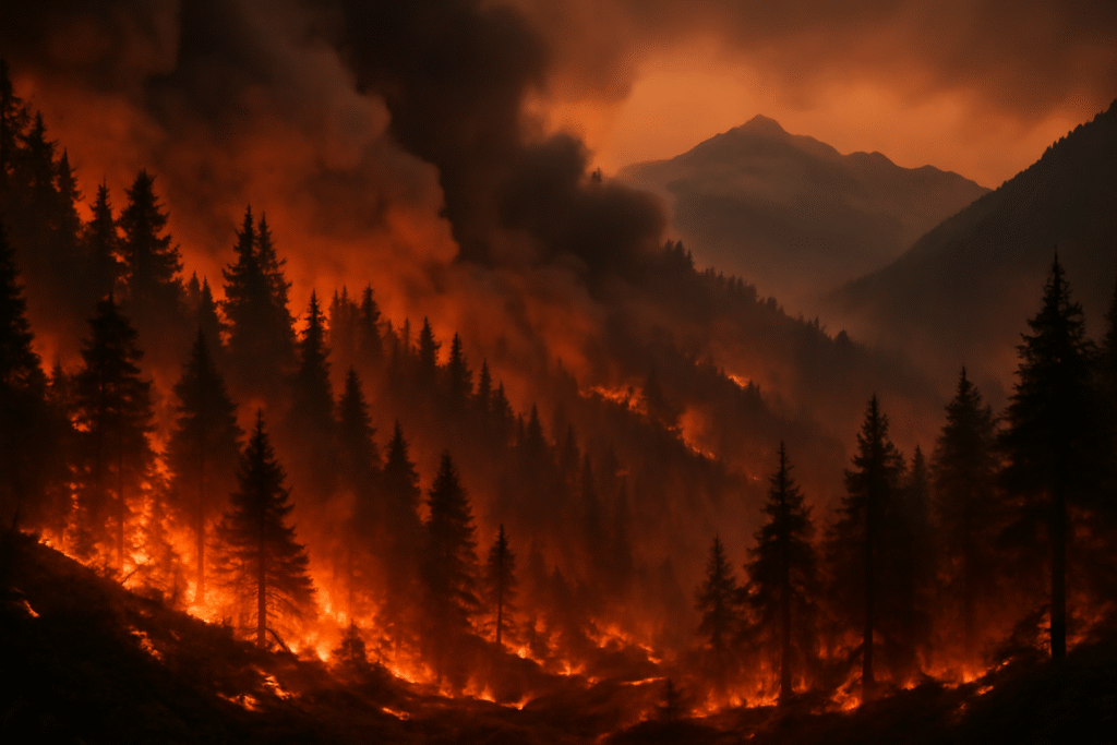
7. The 2016 Uttarakhand Forest Fires: When Mountains Burned
In 2016, Uttarakhand witnessed one of the worst forest fire seasons, with nearly 1,600 fires across the state.
9 people died and 4,538 hectares of forest were destroyed.
The fires caused significant damage to wildlife reserves like Jim Corbett National Park.
8. The 2022 Draupadi Ka Danda Avalanche: India’s Worst Mountaineering Disaster
In October 2022, an avalanche struck Draupadi Ka Danda Peak during an Advanced Mountaineering Course, leading to India’s worst mountaineering disaster.
27 mountaineers died, and several others were trapped.
The avalanche struck during freezing temperatures, making rescue efforts even more difficult.

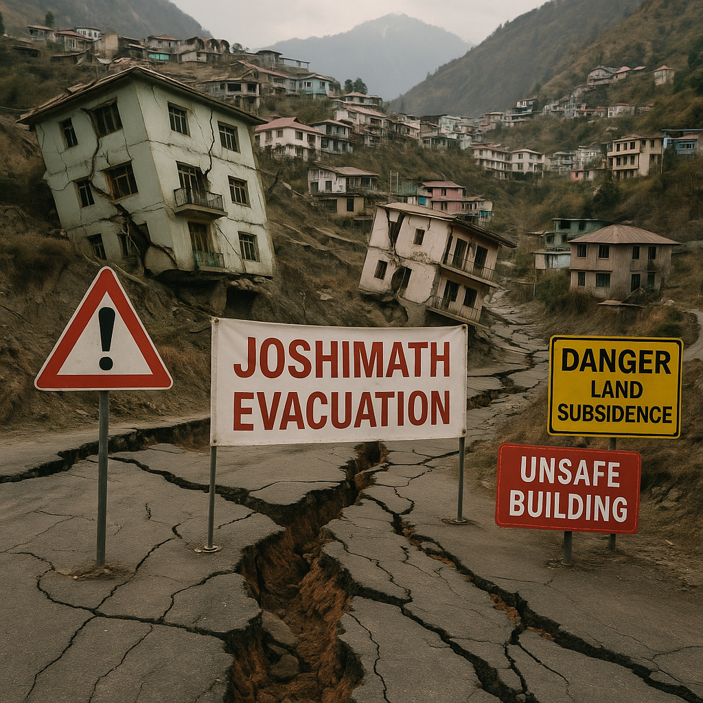
9. The 2023 Joshimath Land Subsidence Crisis: The Sinking Town
The 2023 Joshimath land subsidence crisis marked a unique disaster where an entire town gradually sank.
678 homes developed cracks, and 181 families were evacuated.
Poor construction practices and deforestation contributed to the subsidence.
10. The 2020 Uttarakhand Forest Fires: Pandemic Year Devastation
While the world grappled with the COVID-19 pandemic, Uttarakhand faced its own crisis with widespread forest fires.
46 separate fires were reported, causing destruction to 71 hectares of forest.
The fires continued into October due to a heatwave and unseasonably high temperatures.
Understanding Uttarakhand’s Vulnerability to Natural Disasters
Uttarakhand’s vulnerability to disasters is rooted in its geological and climatic factors:
Seismic instability from tectonic activity in the Himalayas.
Climate change is exacerbating weather patterns, leading to more frequent cloudbursts and flash floods.
Human activities, such as unregulated tourism development, deforestation, and poor urban planning, further compound the risks.
Conclusion: The Need for Better Disaster Preparedness
The Dharali cloudburst tragedy is another painful reminder that Uttarakhand must focus on disaster preparedness. With more frequent natural calamities due to climate change and the state’s geological instability, it’s vital that authorities prioritize early warning systems, sustainable development, and resilient infrastructure to mitigate the devastating impacts of future disasters.
Uttarakhand’s past offers valuable lessons on how to protect vulnerable communities and reduce the impact of natural disasters. The road to recovery will be long, but with adequate support and better planning, the region can prepare for the challenges of the future.

Frequently Asked Questions (FAQs)
1. What caused the Dharali cloudburst tragedy in Uttarakhand?
The Dharali cloudburst was caused by intense rainfall that led to massive flash floods in the Kheer Ganga river. The sudden downpour overwhelmed the village, resulting in water, mud, and debris rushing down the hillside and causing widespread devastation.
2. How many people are missing after the Dharali disaster?
At least 50 people are missing following the Dharali cloudburst tragedy, with fears that they are trapped under debris or buried in the floodwaters. As rescue operations continue, the number may change based on recovery efforts.
3. What other major disasters have occurred in Uttarakhand’s history?
Uttarakhand has experienced several devastating natural disasters, including the 2013 Kedarnath floods, 1991 Uttarkashi earthquake, 2021 Chamoli glacier burst, and 1998 Malpa landslide. These events have claimed thousands of lives and caused significant property damage, making Uttarakhand one of India’s most disaster-prone states.
4. What efforts are being made to help victims of the Dharali cloudburst?
Rescue operations in Dharali are being led by the Indian Army, ITBP, NDRF, and local authorities. The government has activated emergency helplines and deployed personnel to assist those affected. Relief measures include providing shelter, food, and medical supplies to survivors.
5. What were the main causes of the 2013 Kedarnath floods?
The 2013 Kedarnath floods were caused by unprecedented rainfall—375% above normal monsoon levels—combined with the melting of the Chorabari Glacier. This led to massive flooding and landslides, overwhelming the Kedarnath area and causing widespread destruction.
6. How has climate change contributed to the frequency of cloudbursts in Uttarakhand?
Climate change has caused erratic weather patterns, leading to more intense rainfall and increased frequency of cloudbursts in Uttarakhand. The changing climate has exacerbated the risks of flash floods, landslides, and other extreme weather events in the region.
7. What are the key lessons from Uttarakhand’s past disasters?
The key lessons from Uttarakhand’s past disasters include the need for better disaster preparedness, stronger infrastructure, and improved early warning systems. Protecting the region’s fragile ecosystem through sustainable practices and ensuring proper land use are also essential in reducing future risks.
8. What steps can Uttarakhand take to prevent future disasters?
To prevent future disasters, Uttarakhand must focus on sustainable development practices, implement better disaster-resistant infrastructure, invest in early warning systems, and ensure regulations that address environmental preservation and responsible tourism.
9. How can the state improve its disaster preparedness and response systems?
Improving disaster preparedness involves training local communities, enhancing rescue operations, and establishing better communication networks. The state should also focus on strengthening disaster management plans, improving infrastructure, and implementing climate-resilient policies.
10. What impact did the 1991 Uttarkashi earthquake have on the region?
The 1991 Uttarkashi earthquake had a profound impact, killing 768 people and destroying thousands of homes. The earthquake highlighted the region’s vulnerability to seismic hazards, particularly in the Himalayan region, and led to increased awareness about the need for earthquake-resistant buildings.
11. How can Uttarakhand’s fragile ecosystem be protected?
To protect Uttarakhand’s fragile ecosystem, it’s essential to focus on afforestation, regulate tourism, and avoid over-exploitation of natural resources. Additionally, improving water management systems, preventing soil erosion, and reducing deforestation are key steps in maintaining ecological balance.
12. How does Uttarakhand’s geological makeup contribute to its vulnerability?
Uttarakhand’s geological makeup is characterized by its location in the Himalayan mountain range, which is prone to earthquakes, landslides, and flash floods. The region’s unstable tectonic plates, steep slopes, and loose soil contribute to its vulnerability to natural disasters, making it one of the most hazard-prone areas in India.