
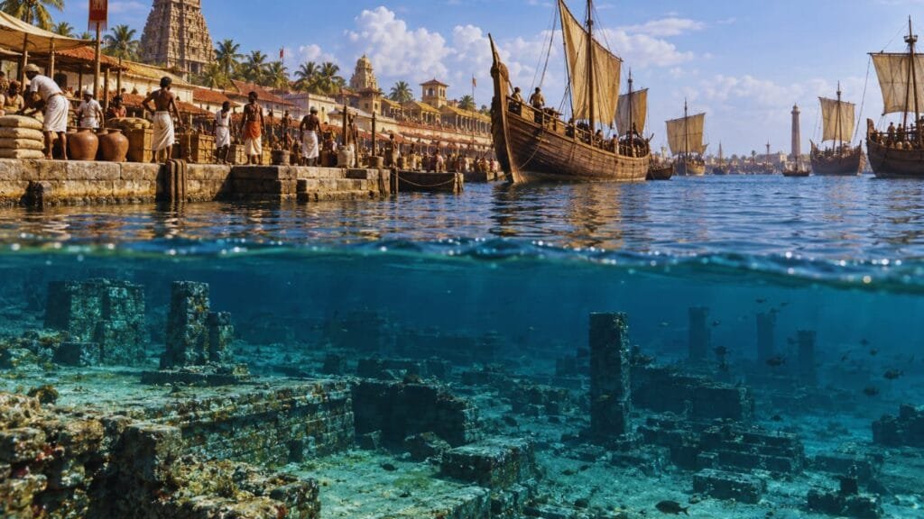
There is a strange moment in archaeology when the map stops making sense.
A city that once stood at the meeting point of the Cauvery River and the Bay of Bengal is now partly represented by structures, pottery and other archaeological remains found beneath or near the modern shoreline.
That city is Poompuhar, also known as Kaveripoompattinam.
And in September 2026, archaeologists are back in the water.
The Tamil Nadu State Department of Archaeology, working with the Indian Maritime University, has begun a fresh phase of underwater excavation off the Poompuhar coast. The team is using sonar and echosounders to identify anomalies on the seabed before divers investigate selected locations. The expedition covers an area of roughly 250 square kilometres, extending about two kilometres offshore and reaching depths of up to 60 metres. New Indian Express — 2026 Poompuhar underwater excavation
But the most interesting question isn’t simply:
Did Poompuhar sink?
It is something harder.
What if Poompuhar wasn’t destroyed in one dramatic event at all?
What if the real story is about a coastline that kept moving?
Poompuhar Was Built Where a River Met the World
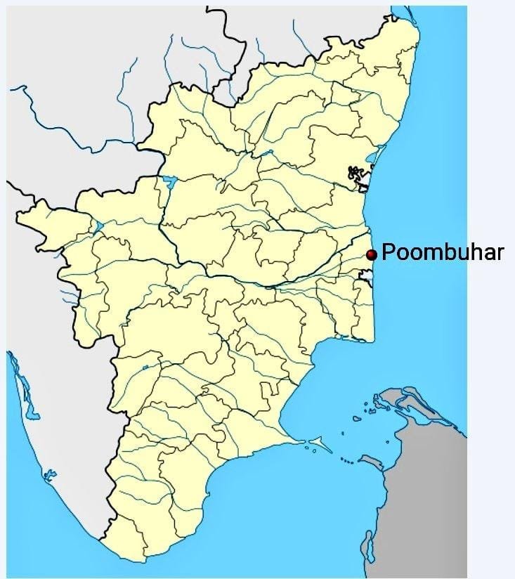
Poompuhar sits near the mouth of the Cauvery in present-day Tamil Nadu.
For an ancient port, that was an extraordinary location.
The river connected the coast with the interior. The Bay of Bengal opened the settlement to maritime routes stretching toward Sri Lanka, Southeast Asia and the wider Indian Ocean.
The Tamil Nadu Department of Archaeology’s account of Poompuhar describes it as a flourishing port and an important Chola centre during the Sangam period. Archaeological investigations around the region have uncovered evidence of settlement, commerce and structures associated with its ancient waterfront.
The name itself tells part of the story.
Poompuhar is also known as Kaveripoompattinam or Kaveripattinam, reflecting its association with the Cauvery.
That geography helps explain its rise.
Ports are rarely successful simply because people decide to build them.
They become powerful when geography does some of the work.
Poompuhar had a river.
It had the sea.
And it occupied a position where those two systems met.
That made it a natural gateway between the Tamil interior and the maritime world.
This Wasn't an Isolated Indian Port
The ancient Indian Ocean was not an empty expanse separating civilizations.
It was a network.
Merchants, sailors, ships and commodities moved between South Asia, Sri Lanka, Southeast Asia and the western Indian Ocean.
Poompuhar was one of the places where that network touched the Tamil coast.
Marine archaeological research by the National Institute of Oceanography identifies Kaveripoompattinam as an important ancient port and records submerged brick and stone structures and terracotta ring wells around the Poompuhar region. Researchers argue that the remains suggest the ancient port extended beyond the present shoreline. National Institute of Oceanography — Marine archaeological research at Poompuhar
Other archaeological discoveries make the maritime connection even harder to dismiss.
Excavations around Poompuhar have produced amphora fragments, rouletted ware, Sri Lankan pottery and a Roman coin. Archaeologists have also identified wharf-related structures and a wooden structure dating to around the fourth century CE. New Indian Express — archaeological evidence from Poompuhar
The significance isn’t one spectacular artefact.
It is the combination.
Pottery.
Coins.
Wharfs.
Foreign material.
Ship-related evidence.
Together, they point toward a port participating in a much larger maritime system.
Poompuhar was not simply a settlement beside the ocean.
The ocean was part of its economy.
Then Archaeologists Started Looking Underwater
The obvious question eventually became unavoidable.
If Poompuhar was such an important coastal settlement, why are archaeological remains now being found offshore?
Tamil Nadu’s underwater archaeology programme began investigating that question decades ago.
The Department of Archaeology records underwater exploration around Poompuhar beginning in the early 1980s, with subsequent marine archaeological work identifying submerged structures and other remains. Tamil Nadu Department of Archaeology — Underwater Archaeology
The National Institute of Oceanography later documented submerged brick and stone structures and terracotta ring wells in the Poompuhar region.
That is important because it takes the story beyond literature.
There is a genuine archaeological problem beneath the water.
But there is also an important distinction.
Finding archaeological remains underwater proves that material is submerged.
It does not automatically prove exactly when every structure was submerged, why it was submerged, or whether the entire ancient city disappeared in one event.
That distinction is where the real Poompuhar mystery begins.
The 85-Metre Structure Beneath the Water
Some of the earlier discoveries are remarkable.
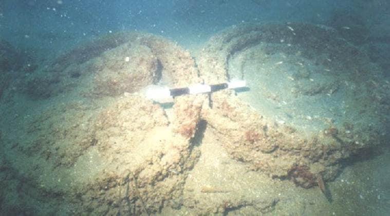
Underwater exploration in the Poompuhar region identified an approximately 85-metre U-shaped stone structure at a depth of around 23 metres, along with pottery and ring-well remains. Researchers also reported a submerged ship during earlier investigations. New Indian Express — Poompuhar underwater discoveries
Other investigations found brick structures and archaeological material in shallower waters.
But these discoveries don’t give archaeologists a neat underwater street map.
Instead, they create a much harder puzzle.
What was part of the harbour?
What belonged to the settlement?
What was built beside an ancient river channel?
What was later buried by sediment?
What was moved by currents?
And what represents a completely different period of activity?
Those questions matter because the seabed is not a frozen archaeological landscape.
It changes.
Sediment moves.
Structures collapse.
Currents redistribute objects.
Coastlines retreat.
And rivers change course.
The Coastline May Be the Real Story
This is where Poompuhar becomes much more interesting than a conventional “lost city” story.
Imagine looking at the modern coastline.
Now imagine moving that coastline inland.
Then imagine the river changing its course.
Add erosion.
Storms.
Sediment.
Changes in sea level.
Occasional extreme events.
Over centuries, the map can become almost unrecognisable.
Poompuhar existed at the intersection of two highly dynamic environments:
a major river and the sea.
That was its strength.
It may also have been its vulnerability.
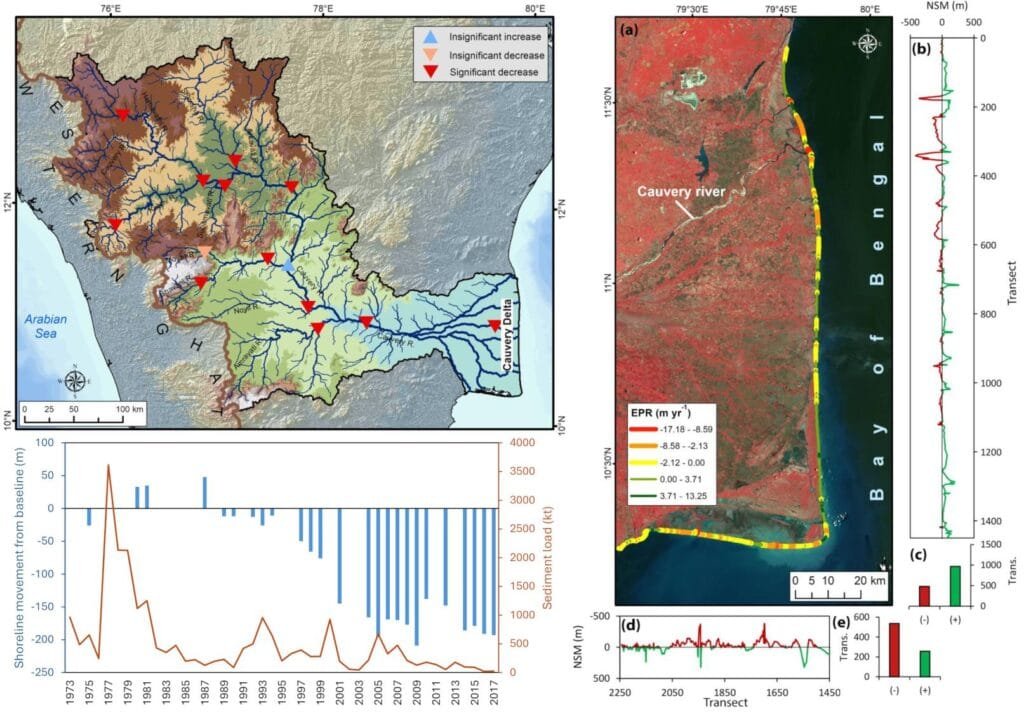
Research into the Poompuhar coast has examined shoreline changes and the possible submergence of coastal areas. Scientists have considered processes including coastal erosion, sea-level change, sediment movement, storms, tsunami events and tectonic activity when interpreting the region’s changing landscape. National Institute of Oceanography — research on Poompuhar’s submergence
That doesn’t mean one of those processes can be declared the single answer.
It means the disappearance of the ancient coastline may have been the result of several interacting processes over time.
And that possibility is far more important than the popular image of one city suddenly being swallowed by the sea.
So, Did a Tsunami Destroy Poompuhar?
This is probably the first question most people ask when they hear about a submerged Poompuhar.
The answer is:
We don’t know that a single tsunami destroyed it.
Ancient Tamil literature contains accounts associated with the submergence of Poompuhar. The story is particularly prominent in Manimekalai, which describes the city being swallowed by the sea.
The literary tradition is genuine.
But literature and archaeology answer different questions.
A literary account can preserve memories, beliefs, cultural traditions or descriptions of environmental events. It doesn’t automatically provide a scientifically dated account of a specific disaster.
Researchers have suggested that the literary story may preserve an echo of coastal erosion or a major wave event, but that remains an interpretation rather than proof of one catastrophic destruction. National Institute of Oceanography — Underwater Exploration off Poompuhar
So the responsible answer isn’t:
“A tsunami sank Poompuhar.”
It is:
Poompuhar experienced significant coastal change and has submerged archaeological remains, but the exact combination of processes responsible for its transformation is still being investigated.
That distinction might make the story less sensational.
It also makes it more credible.
The Forgotten Cities of India Often Hide in Plain Sight
Poompuhar isn’t unique in one important respect.
India has repeatedly built major settlements whose importance became obscured by later political centres, changing landscapes and centuries of neglect.
Your next clue is inland.
At Lakkundi, another archaeological story shows how a once-important historical centre can fade from popular memory while its architecture, inscriptions and water structures remain.
HypeHive’s exploration of Lakkundi’s hidden history follows a similar pattern: the interesting part isn’t simply that an old city existed. It is how much information survives after the world around it has changed.
Poompuhar takes that phenomenon one step further.
At Lakkundi, much of the evidence remains on land.
At Poompuhar, some of the archaeological story is now being reconstructed from the seabed.
Water Built Poompuhar — and May Have Helped Transform It
There is another connection worth making.
Civilizations don’t merely live beside water.
They organize themselves around it.
Rivers determine agriculture, transport, settlement and trade. Communities build systems to control, redirect and store water. Ports depend on channels that remain navigable.
That is why Poompuhar belongs to the much larger story of water management in India.
The same fundamental problem appears again and again throughout Indian history:
How do you build a civilization around water without becoming vulnerable to it?
For Poompuhar, the answer may have been especially difficult.
The Cauvery made the location valuable.
But a river delta is never completely static.
The river deposits sediment.
Channels shift.
The coast changes.
And the sea constantly interacts with the land.
A port that depends on a particular combination of river and sea can therefore be extremely successful—and extremely sensitive to environmental change.
Archaeologists Are Now Using Technology to Reconstruct the Lost Coast
The latest Poompuhar expedition is not simply a group of divers searching randomly through the water.
The investigation is increasingly technological.
The 2026 excavation is using side-scan sonar and echosounders to identify anomalies on the seabed before divers investigate selected locations. Earlier phases of the recent research included underwater surveys and diving operations, while researchers have also reported possible submerged structures and a possible shipwreck. New Indian Express — 2026 underwater investigation
This changes what underwater archaeology can ask.
Instead of simply looking for visible ruins, researchers can map the seabed and identify patterns.
A sonar anomaly can point toward something buried.
A submerged channel can reveal how a river once moved.
The distribution of artefacts can indicate where human activity occurred.
And multiple layers of evidence can be combined to reconstruct a landscape that no longer exists.
There is an interesting modern parallel here.
India’s ability to understand landscapes from above has become a major part of its scientific history. HypeHive’s history of India’s space programme traces how India moved from early satellite experiments toward increasingly sophisticated Earth-observation capabilities.
Poompuhar shows the opposite perspective.
Instead of looking down from space, archaeologists are now looking down through the water.
Different technology.
Same basic question:
What was here before?
What Archaeologists Are Looking for in 2026
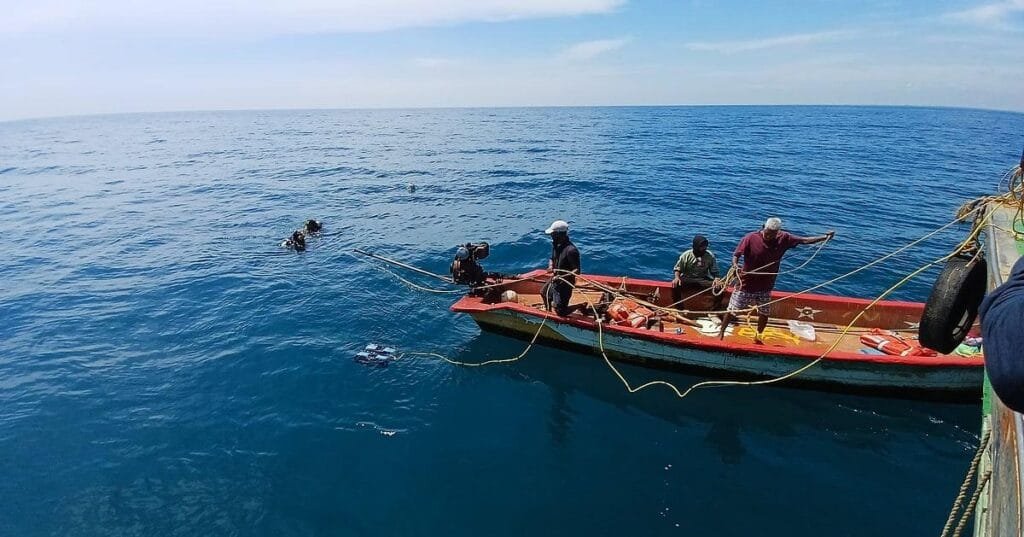
The current expedition has ambitions beyond finding another interesting object.
Researchers want to establish the extent of the ancient port and associated structures.
They also want to investigate possible shipwrecks, changes in sea level and river courses, and Poompuhar’s role in ancient international maritime trade. New Indian Express — current Poompuhar excavation objectives
Preliminary studies began in 2025, followed by underwater surveys and diving operations in 2026.
Those investigations reportedly identified pottery fragments that appeared to include Tamil and foreign material, an elliptical structure near a previously identified U-shaped structure, other buried structures and a possible shipwreck. New Indian Express — preliminary Poompuhar findings
The objective is therefore not to prove a legend.
It is to reconstruct a landscape.
That is a much more ambitious scientific project.
How Much of Poompuhar Have We Actually Found?
Not enough to draw a complete underwater city.
That reality is important.
There are genuine archaeological discoveries from the Poompuhar region: submerged structures, ring wells, pottery and evidence associated with ancient maritime activity. The Tamil Nadu Department of Archaeology’s underwater archaeology programme documents the broader history of these investigations.
But archaeologists are still trying to determine the full extent of the ancient port and understand how its remains relate to changing environmental conditions.
So headlines claiming that the entire lost city of Poompuhar has been discovered underwater go further than the evidence currently allows.
The same caution should apply to extremely ancient reconstructions that attempt to push Poompuhar far deeper into prehistory.
Those hypotheses may be interesting subjects for research.
They should not be presented as established archaeological fact without securely dated evidence.
The real story is already extraordinary.
It doesn’t need exaggeration.
A City Doesn't Have to Disappear All at Once
We tend to imagine lost cities in cinematic terms.
A volcano buries one.
An earthquake destroys another.
A legendary city disappears beneath the sea.
But coastal archaeology often tells a slower story.
A port can gradually become harder to use.
A river can migrate.
A shoreline can retreat.
Buildings can be abandoned.
Storms can damage infrastructure.
Sediment can cover structures.
Later generations can move elsewhere.
And after centuries, the original landscape can become almost impossible to recognise.
That may be a better way to understand Poompuhar.
Instead of asking:
What catastrophe sank the city?
we should ask:
What combination of environmental and human changes transformed a major port into an archaeological landscape?
That question doesn’t make Poompuhar less mysterious.
It makes the mystery bigger.
Poompuhar Is Really a Story About Moving Maps
The deepest lesson of Poompuhar may have little to do with lost cities.
It may be about how temporary human geography really is.
We draw borders.
We build ports.
We establish capitals.
We put roads along coastlines.
Then the physical world keeps moving.
Rivers migrate.
Deltas grow.
Shorelines retreat.
Storms reshape beaches.
Sediment accumulates.
The relationship between land and sea changes.
Thousands of years later, archaeologists may have to reconstruct an entire civilization from fragments beneath the water.
That is what makes Poompuhar so fascinating.
The city isn’t simply waiting to be “found.”
Its landscape has changed.
Its coastline has changed.
Its river system has changed.
And the archaeological remains have been scattered across different environments—land, intertidal zones, sediment and seabed.
The challenge isn’t just discovering objects.
It is understanding the landscape that produced them.
The Sea Has Not Finished Rewriting Poompuhar
In September 2026, archaeologists are once again descending into the waters off Tamil Nadu’s coast.
They aren’t simply searching for a mythical lost city.
They are trying to answer a much harder question:
What did this coastline look like when Poompuhar was one of the great maritime gateways of ancient Tamilakam?
Every structure can help.
Every pottery fragment can help.
Every sonar anomaly can help.
Even the absence of something can help.
Because Poompuhar’s greatest secret may not be that an ancient city disappeared beneath the sea.
It may be that the city we are looking for never occupied exactly the same coastline throughout its history.
The port was built where river and sea created opportunity.
Those same forces eventually transformed the landscape around it.
And now, more than a millennium later, archaeologists are trying to read that changing coastline backwards—from the seabed to the shore, from fragments to a city, and from a city to the world it once connected.
Poompuhar isn’t just a lost port.
It is a record of what happens when civilization builds on a coastline that refuses to stay still.